

IMMISnetis a Gaussian multi-source dispersion model for calculating the spatial extent of concentration levels of air pollution. Treated as a stationary process, the model describes the dilution and transport of pollutants from point, line or area sources, using a Gaussian normal distribution. Gaussian dispersion models are instruments that have been tried and tested for many years to deal with problems of air pollution distribution, be it within the framework of plans for maintaining air quality, or within planning permit procedures. 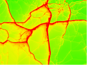 Range of application• Calculation of regional and urban background concentrations • Calculation of roof-top concentrations as back-ground for micro-scale modelling of street canyons • Calculation of hourly concentrations at receptor points • Calculation of statistical parameters (annual mean values and percentiles) • Simultaneous calculation of up to 10 pollutants | Input data
Functionality
 | GIS IntegrationThe software is available as integration into ArcGIS®. 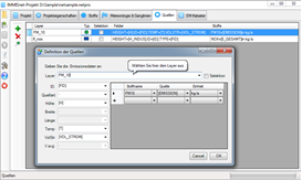  |